Resources

ROBSON VALLEY MAP
Glaciers, rivers, towns, and location of meteorological, hydrological, and snow stations. 11 x 17” size, great for printing!
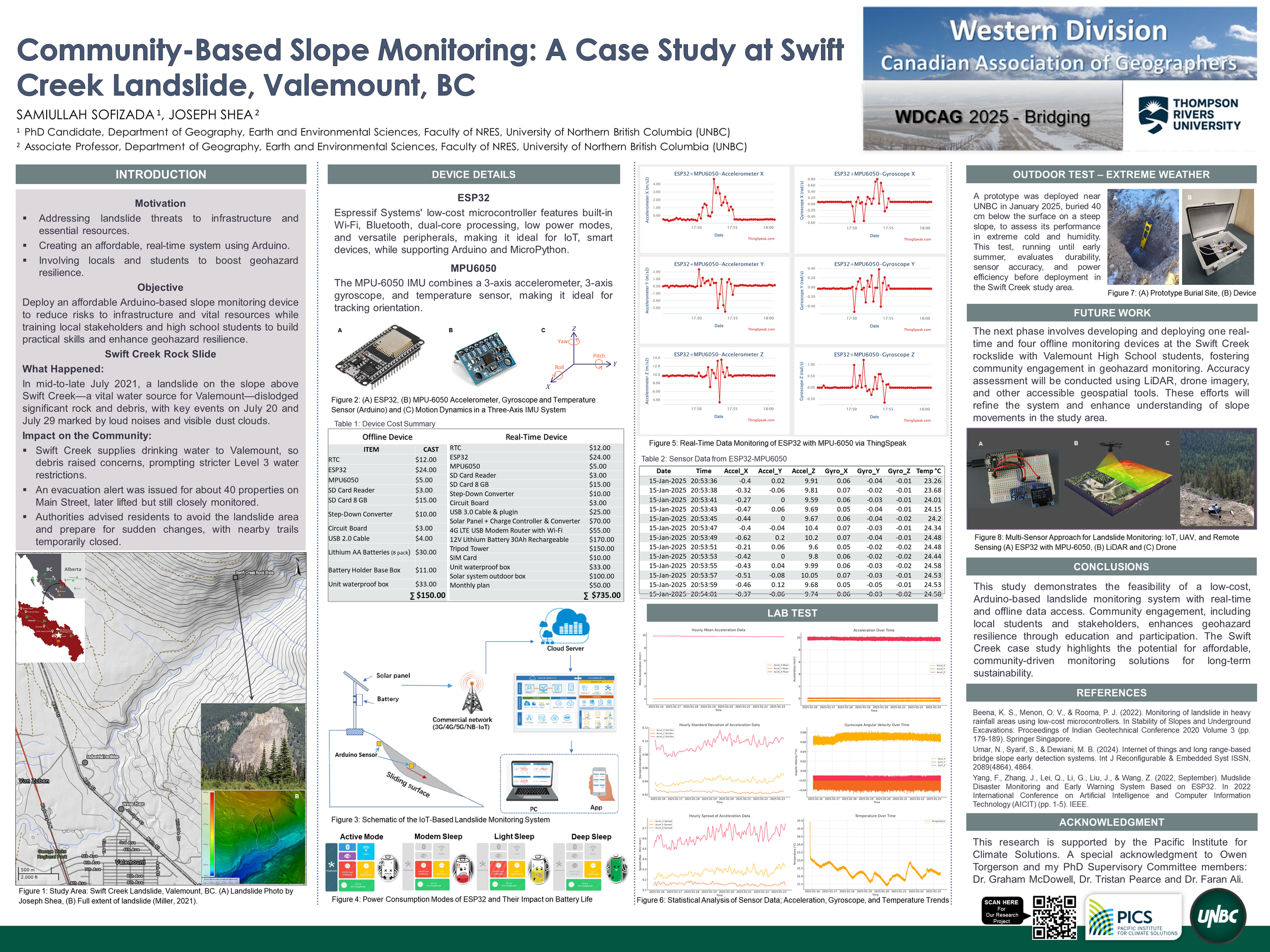
Community-Based Slope Monitoring: Case STudy at Swift Creek, Valemount, BC
Award-winning poster presented by Sami Sofizada at the Western Division of the Canadian Association of Geographers Annual Meeting in Kamloops, March 2025.
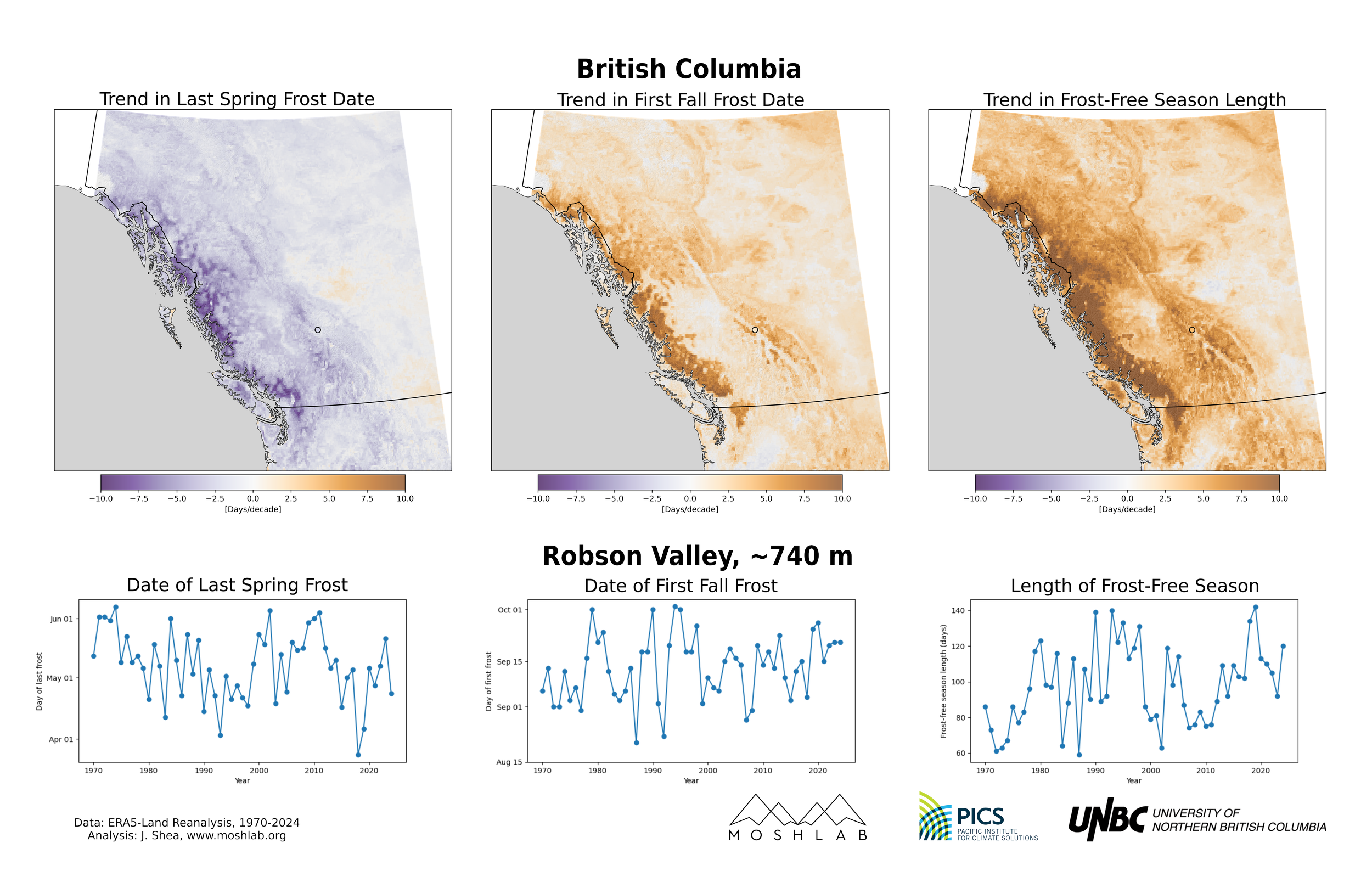
Frost season Trends - BC + Robson Valley
Maps of trends in Last Spring Frost, First Fall Frost, and Length of Frost Free Season (in days/decade) from ERA5-Land Reanalysis. Time series for a single point in the Robson Valley.
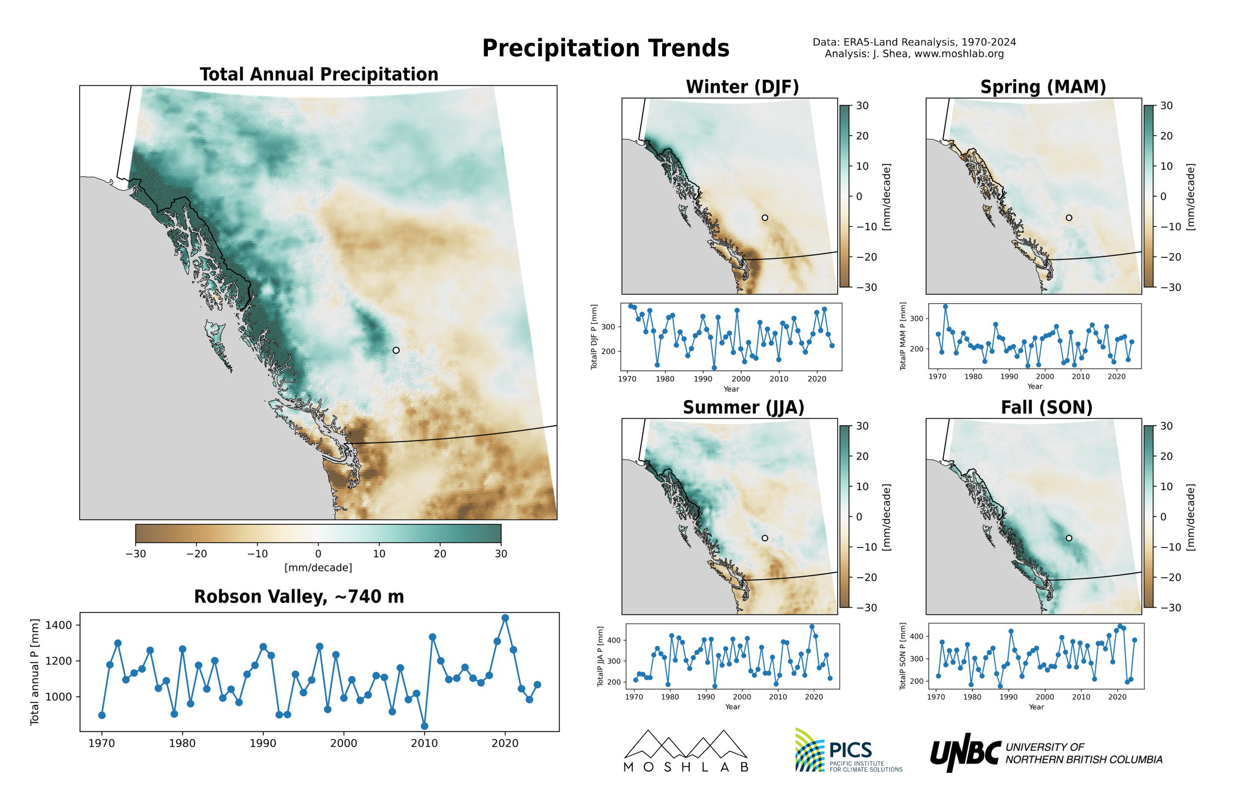
Precipitation Trends - BC + Robson Valley
Maps of trends in annual and seasonal precipitation (mm/decade) from ERA5-Land Reanalysis. Time series for a single point in the Robson Valley